AgroQR Overview
Project Basics
Name: AgroQR – Hyperlocal Environmental Intelligence
Builders: Saket Pradhan, Harsh Rana
Concept born: March 2024
Location: Ann Arbor, MI (Saket) and Berkeley, CA (Harsh)
Website: https://www.useagroqr.com/
Funding Status: Raised $5K from UMich CFE
Mission & Problem
AgroQR tackles the broken state of climate and environmental monitoring. Traditional solutions—IoT sensors ($100+/unit, high upkeep, battery-dependent) and satellites ($10M+ missions, low-res, rigid)—fail to deliver affordable, real-time, hyperlocal insights for industries, governments, and regulators tracking pollution, climate shifts, and resources. The unique insight: customers crave granular coverage over pinpoint precision—90% accuracy at a fraction of the cost wins.
Solution
AgroQR redefines monitoring with:
Passive QR Sensors: Chemical-coated, power-free sensors log air (CO₂, SO₂), soil (pH, nitrates), and climate data via color shifts—2% of IoT costs, lasting 10-14 months.
Drone Fleet: Autonomous drones scan at 35 mph, covering 100+ acres in minutes—no RF needed.
API Delivery: Decodes QR data into real-time insights, accessible anywhere.
This trio delivers “general enough, fast enough, sharp enough” data—versatile, scalable, and cost-effective.
Product Details
Sensors: Detect PM2.5 (±25 µg/m³), SO₂ (±20 ppm), NOx (±50 ppm), CO (±20 ppm), VOCs (±50 ppm), O₃ (±50 ppb), NH₃ (±20 ppm), sulfates (±50 ppm), nitrates (±100 ppm), soil pH (±0.1-0.5).
Drones: 35 mph, ~10 min/100 acres, scalable via fleets.
Cost: 2-4% initial, 15-20% operational vs. IoT.
Tech Stack: Python/FastAPI, ROS2, OpenCV, TensorFlow, AWS-hosted.
Traction
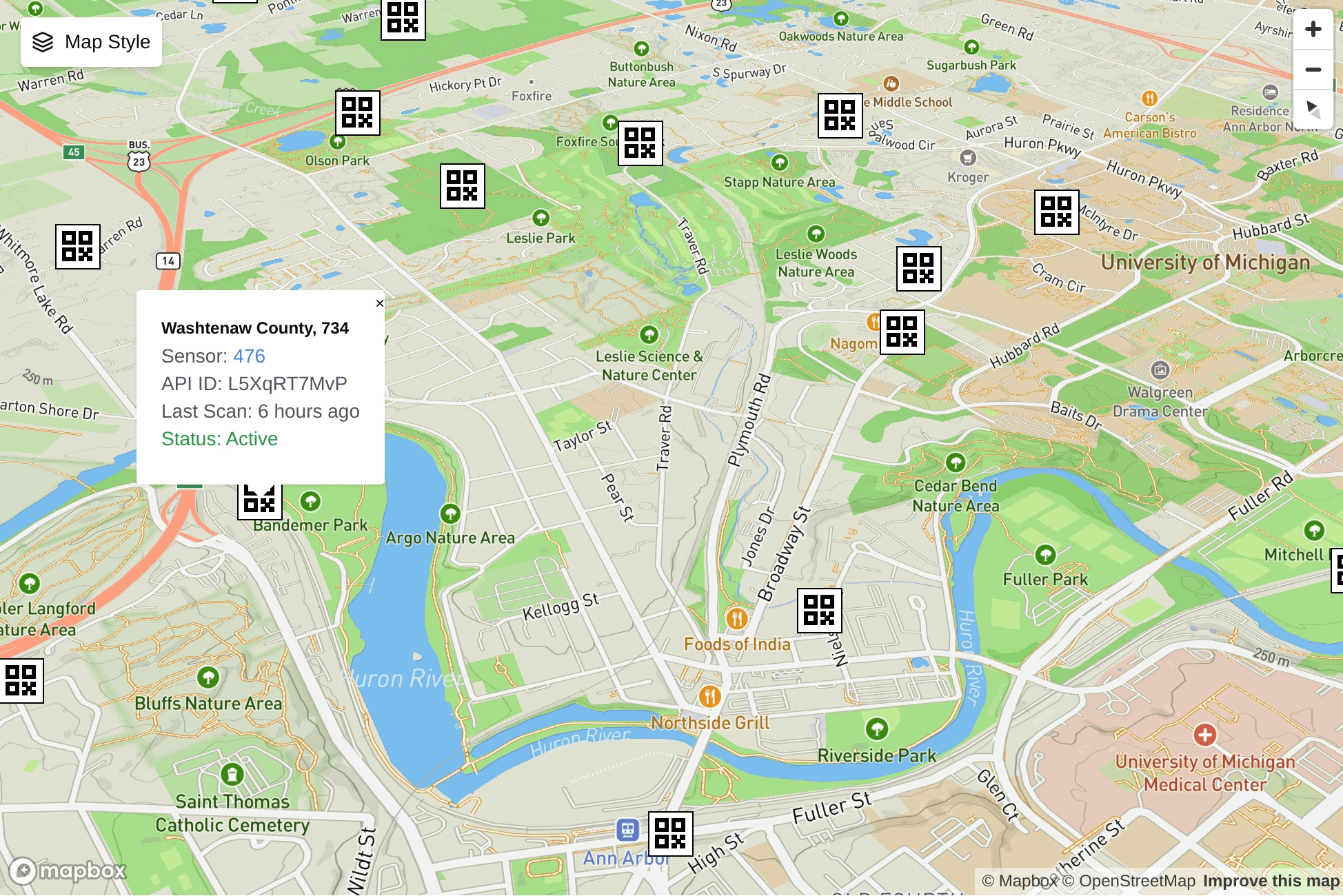
Prototype: QR mounts, drone scans, API—all functional since Q1 2025.
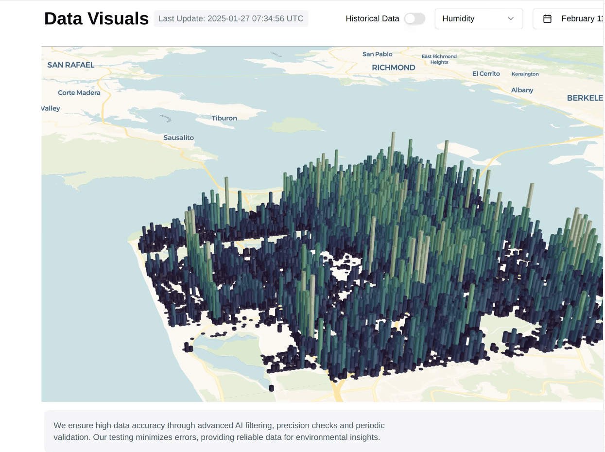
Field Testing: Launched March 2025 in Ann Arbor, scanned 5+ acres, expanding to Berkeley April 2025.
API Tokens: ~10 testers on proxy data.
Programs: Selected for NSF I-Corps Great Lakes W25.
Market Opportunity
Total Market: Earth Observation (EO) Data, including climate, projected at $700B by 2030.
U.S. Focus: TAM $100B-$200B by 2025.
Bottoms-Up: 10-50 U.S. clients (industrial/gov), 1-200 sites each (100-10,000 acres), $30K-$250K/year per 1000 acres = $3M-$50M SOM; $500M-$1B SAM with API subscriptions.
Approach: Start with U.S. pilots (Ann Arbor, Berkeley), scale to industrial/gov clients by Q3 2025, targeting $1M ARR by 2026.
Competitors
IoT: Semios, Teralytic—$100-$300/unit, high upkeep, niche.
Satellites: Matter Intelligence (Pear-backed)—millions, low granularity.
Differentiation: 2% IoT cost, no power, 35 mph drones, general-purpose (air, soil, climate) vs. niche overkill.
Builders
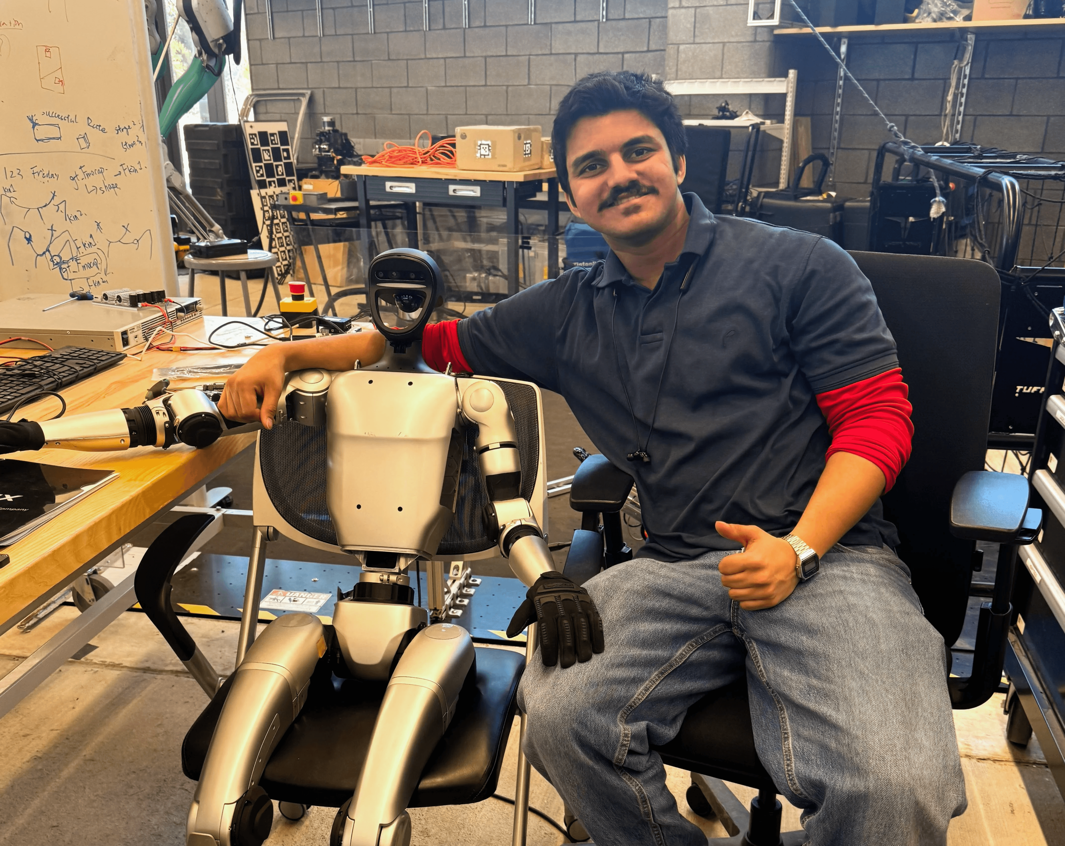
Saket Pradhan
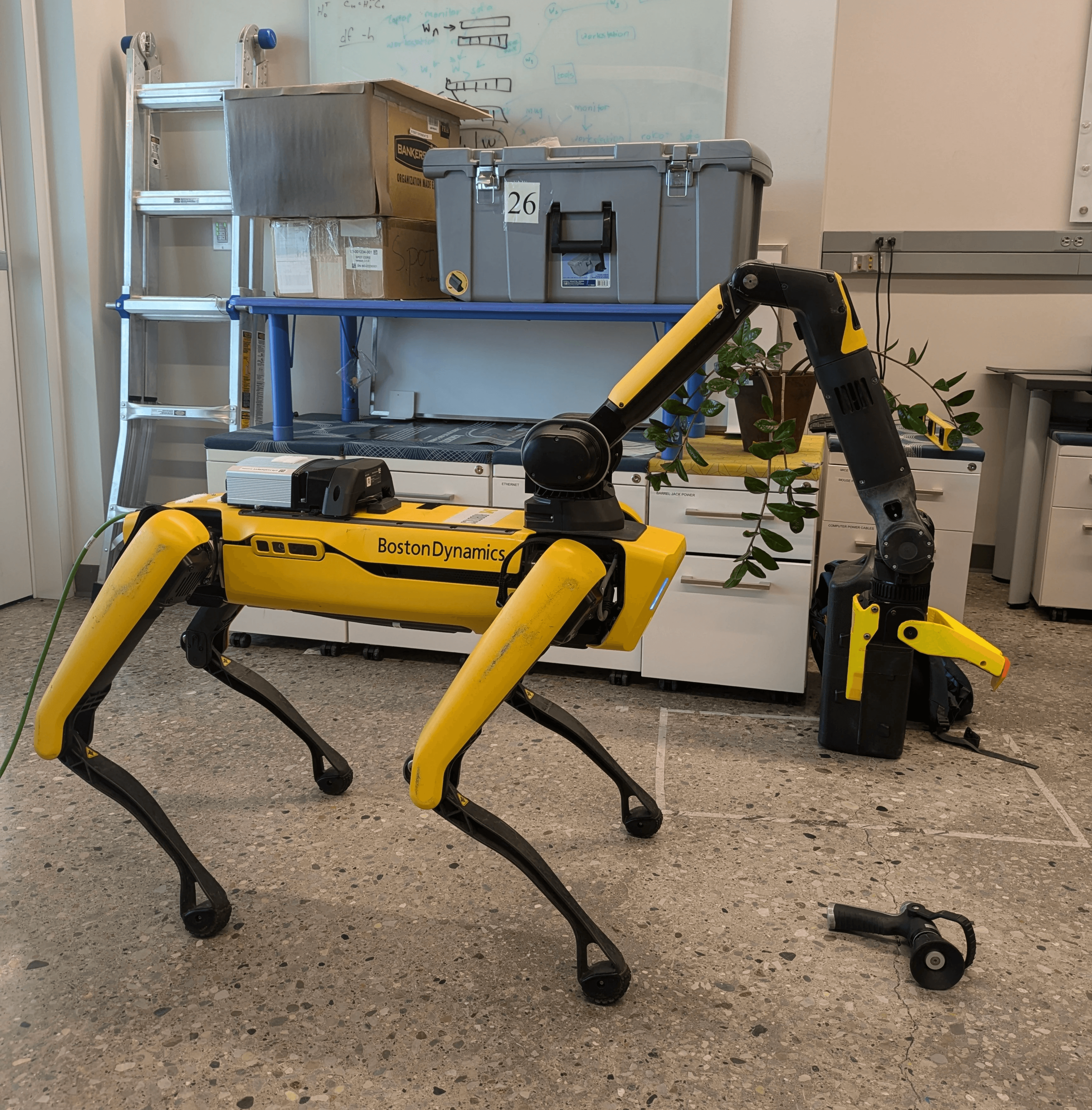
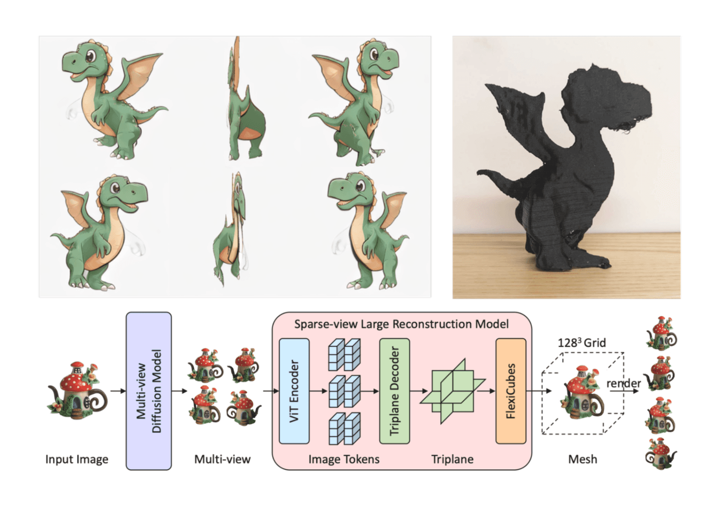
Ex-InVideo coder (Jan-Aug 2023), hacked NeRF avatars for $70M ARR pivot; UMich robotics (Spot perception, Unitree G1); software, vision, geospatial expert.
Harsh Rana
Background: Bajaj robotics (Aug 2023-May 2024), $2.25M daily output with Fanuc/3D vision; UC Berkeley drone/ROS2 expert, patent savvy.
Partnership: Friends since 4th grade Mumbai, 15+ years of tech collaboration.